
How Much Does a Matterport Virtual Tour Cost in Toronto?
Matterport 3D virtual tour pricing in Toronto starts at $249. See the full cost breakdown for virtual tours, floor plans, photography, drone, and virtual staging.
Author: Jonas Lood, Lightbound 3D
A Matterport 3D virtual tour in Toronto starts at $249 for a standard scan. But the total cost depends on what you need — floor plans, photography, drone imagery, virtual staging, and hosting all factor in. This guide breaks down exactly what each service costs so you can budget accurately before reaching out to a provider.
At Lightbound 3D, we publish our pricing upfront because we believe you shouldn't have to sit through a sales call to get a number. Here's what everything costs in 2026.
Matterport Virtual Tour Pricing in Toronto
Our standard Matterport packages are flat-rate and available to order directly online:
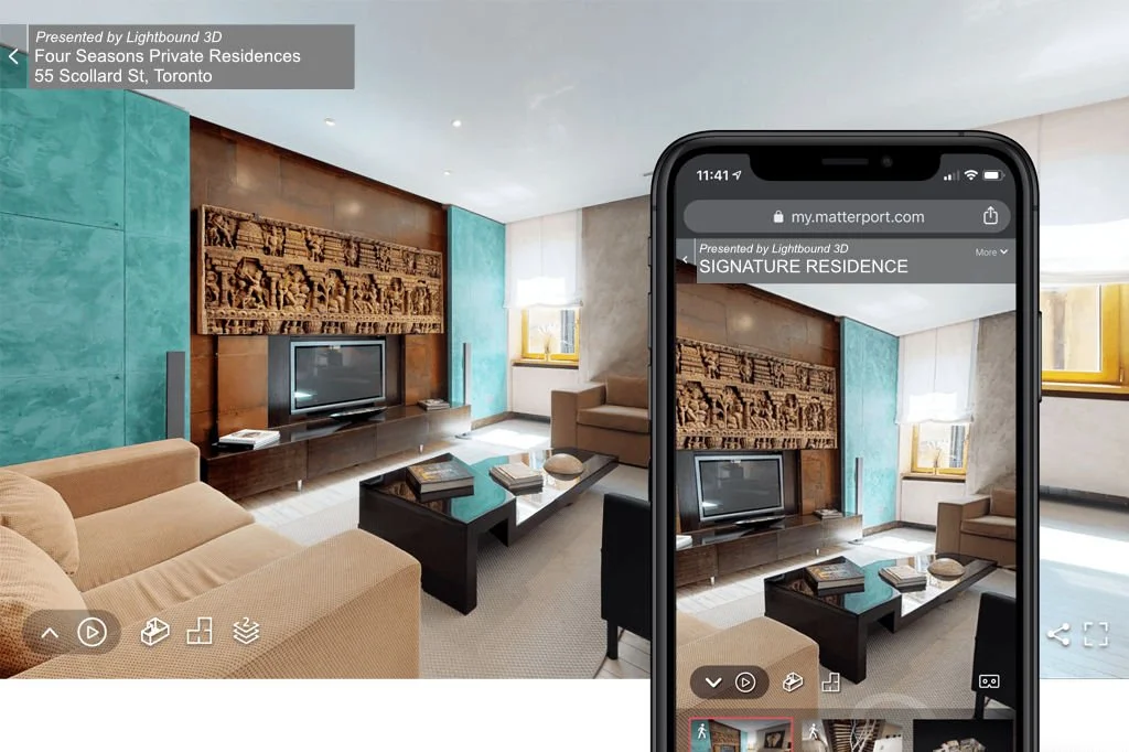
Matterport 3D Virtual Tour — $249. This includes a complete interactive 3D walkthrough of your space, hosted online and shareable via link. Suitable for residential listings, small commercial spaces, and single-unit properties.
Matterport 3D Virtual Tour + Floor Plan — $349. Everything in the standard tour plus a schematic floor plan with room dimensions. This is the most popular package for real estate agents who need both a virtual walkthrough and a layout document for their listing.
Photography and Drone Pricing
Real Estate and Architectural Photography — $529. Professional HDR photography for residential and commercial listings, covering interiors and exteriors.
Aerial Drone Panorama Photo — $189. A single aerial panorama showcasing the property and surrounding area from above.
Drone Photography Pro Image Package — $629. A comprehensive aerial photography package with up to 15 professional drone images covering multiple angles, elevations, and perspectives.
Virtual Staging Pricing
Virtual Staging — $425 for five rooms. We digitally furnish empty rooms with realistic, high-quality furniture and decor. This is a flat rate per room with fast turnaround — a fraction of what physical staging costs, which typically runs $3,000 to $8,000 or more for a full home in the Toronto market.
Bundle Pricing: The Interactive Listing Package
Interactive Listing Package — $679. This combines a Matterport 3D virtual tour, floor plan, and professional photography into one package at a better price point than ordering each separately. If you need the full digital marketing package for a listing, this is the best value.
Hosting Costs
Space Hosting — $9.99 per month. Your Matterport 3D tour needs to be hosted online to remain accessible. This covers cloud hosting for your virtual tour on our platform. Tours remain live and shareable as long as hosting is active.
3D Laser Scanning and Scan to BIM Pricing
For commercial, construction, and AEC clients, pricing depends on project scope:
3D Laser Scanning — from $1,500. High-accuracy LiDAR scanning for commercial buildings, construction sites, and facilities. Includes registered point cloud delivery in .rcp, .e57, and .las formats. Final pricing is based on square footage, number of floors, and site complexity.
Scan to BIM Modeling — from $2,000. We convert point cloud data into Revit BIM models for architects, engineers, and contractors. Includes LOD 200 as-built modeling. LOD 300 and LOD 400 available on request. Pricing depends on model detail, building complexity, and deliverable requirements.
For scanning and BIM projects, we provide a custom quote after understanding your scope. You can request one through our contact form or call us directly at 437-775-9000.
What Factors Affect Matterport Tour Pricing?
While our standard packages are flat-rate, a few factors can affect pricing for larger or more complex projects. Property size matters — spaces over 5,000 SF or with multiple floors may require additional scan time. Travel distance outside the GTA may include a travel surcharge. Multi-property or ongoing engagements, like the facilities management programs we run for restaurant chains across Ontario, are quoted on a per-project or retainer basis.
How Toronto Pricing Compares
Matterport pricing in Toronto is broadly consistent across providers for standard residential scans — most fall in the $200 to $400 range for a basic tour. Where providers differ is in quality, turnaround time, and what's included. Some charge separately for hosting, floor plans, or post-processing that we include as standard. Always confirm what's included before comparing prices.
Frequently Asked Questions
How much does a basic Matterport tour cost in Toronto? A standard Matterport 3D virtual tour in Toronto starts at $249 from Lightbound 3D. This includes a complete interactive 3D walkthrough hosted online. Adding a floor plan brings the price to $349.
Is virtual staging cheaper than physical staging? Yes. Virtual staging costs $425 for five rooms compared to $3,000 to $8,000 or more for physical staging of a full home in the Toronto market. The results are comparable for listing photos and online presentation.
Do I have to pay for hosting separately? Yes. Matterport tours require cloud hosting to remain accessible online. Hosting is $9.99 per month per space. Tours remain live and shareable as long as hosting is active.
How do I get a quote for 3D scanning or Scan to BIM? 3D laser scanning starts at $1,500 and Scan to BIM modeling starts at $2,000, with final pricing based on project scope. Contact us for a custom quote or call 437-775-9000.
Ready to Order?
You can order a Matterport virtual tour, photography, virtual staging, or our Interactive Listing Package directly from our online catalogue — no sales call required.
Order Now | Learn More About Our Matterport Services | Explore Our Projects
As-Built Drawings Toronto: What They Are, When You Need Them, and How to Get Them Fast
If you've ever tried to renovate a building, apply for a permit, or hand off a construction project in Toronto, chances are someone has asked you for as-built drawings. But what exactly are they, how do you get them, and why does it seem to take forever?
This guide answers those questions — and explains why more architects, engineers, and contractors in the GTA are turning to 3D laser scanning to get accurate as-builts in a fraction of the time.
What Are As-Built Drawings?
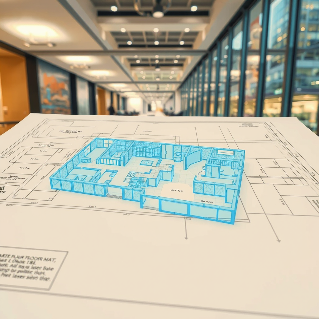
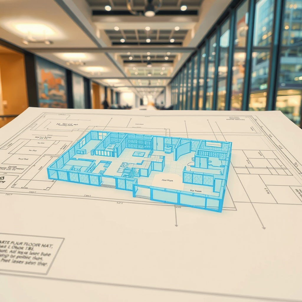
As-built drawings (also called record drawings or as-built plans) are architectural or engineering drawings that document a building as it actually exists — not as it was originally designed. They reflect every change made during construction, every deviation from the original blueprint, and every feature of the structure as it stands today.
They typically include:
Floor plans with accurate dimensions
Reflected ceiling plans
Electrical and mechanical layouts
Structural elements such as columns, beams, and load-bearing walls
Door and window schedules
Exterior elevations
The key word is accurate. An as-built drawing is only useful if it reflects reality — and that's where traditional methods often fall short.
When Do You Need As-Built Drawings in Toronto?
As-built drawings are required in a wide range of situations. The most common include:
Renovation and retrofit projects. Before any structural or mechanical work begins, contractors and architects need to understand what's already there. As-builts prevent costly surprises mid-project.
Building permit applications. The City of Toronto and most GTA municipalities require accurate floor plans and elevations as part of permit submissions for alterations, additions, or change-of-use applications.
Property transactions. Buyers, lenders, and insurers increasingly require accurate documentation of a building's existing conditions — especially for commercial and industrial properties.
Facility management. Building owners and managers need up-to-date drawings to plan maintenance, manage space, and coordinate tenant fit-outs.
Heritage preservation. Toronto has a significant stock of older buildings where original drawings no longer exist or are inaccurate. As-builts are essential before any restoration work.
Legal and insurance disputes. Accurate documentation of a building's existing state can be critical in resolving disputes over construction defects or damage claims.
How Are As-Built Drawings Produced?
There are two main approaches: traditional field measurement and 3D laser scanning.
Traditional field measurement involves a technician physically measuring a space with tape measures, laser distance meters, and hand sketches, then drafting the drawings in CAD software. It's time-consuming, error-prone, and often results in drawings with tolerances of 1–3 inches — which can cause serious problems downstream.
3D laser scanning uses a high-precision scanner to capture millions of data points across a space in minutes, generating a dense point cloud that accurately captures every surface, structural element, and feature of the building to within 2–3 millimetres. That point cloud is then used to produce highly accurate CAD drawings or full BIM (Building Information Models) in Revit.
For anything beyond a simple single-room renovation, laser scanning is faster, more accurate, and ultimately more cost-effective — because errors caught in the drawing stage cost far less than errors caught on site.
As-Built Drawings vs. Scan-to-BIM: What's the Difference?
As-built drawings are 2D representations — floor plans, elevations, sections. Scan-to-BIM takes the same laser scan data and produces a full 3D model in Revit or AutoCAD, where walls, floors, ceilings, MEP systems, and structural elements are modelled as intelligent objects.
For simple permit applications or renovation planning, 2D as-builts are often sufficient. For complex commercial projects, mechanical coordination, or clash detection, a full BIM model is the right tool.
Lightbound 3D offers both — we can produce 2D as-built drawings from our laser scan data or deliver a full Scan-to-BIM model depending on what your project requires.
What Do As-Built Drawings Cost in Toronto?
Pricing varies based on the size and complexity of the space, the level of detail required, and the deliverable format (2D CAD vs. full BIM model).
As a general guide:
Small spaces (under 2,000 sq ft): Starting from $1,500
Mid-size commercial (2,000–10,000 sq ft): $2,500–$6,000
Large or complex buildings: Quoted on project scope
Traditional measurement-based as-builts may appear cheaper upfront but often require return site visits to verify measurements — adding cost and delays. Laser scanning captures everything in a single site visit, reducing overall project time and risk.
Why Toronto Projects Choose Lightbound 3D
Lightbound 3D is a Toronto-based 3D scanning and BIM company serving architects, engineers, contractors, and property owners across the GTA. We use professional-grade laser scanning equipment to capture existing conditions accurately and efficiently, then deliver as-built drawings or Scan-to-BIM models in the format your project requires.
Our work spans commercial offices, residential buildings, heritage properties, industrial facilities, and retail spaces across Toronto, Mississauga, Brampton, Vaughan, and the broader GTA.
Ready to get started? Request a quote for as-built drawings →
Or learn more about our Scan-to-BIM services in Toronto →
Frequently Asked Questions
-
With 3D laser scanning, most projects are completed within 3–7 business days from the site visit. Complex buildings or large floor plates may take longer. Traditional measurement-based methods typically take 2–4 weeks.
-
Yes — the City of Toronto requires accurate existing condition drawings as part of most permit applications for alterations, additions, or change-of-use. As-built drawings produced from laser scan data are accepted by the City and meet the required accuracy standards.
-
Construction drawings (also called design drawings or working drawings) show what a building is intended to look like when built. As-built drawings show what the building actually looks like after construction — including any deviations from the original design.
-
Yes. This is one of the most common scenarios we encounter in Toronto. Laser scanning captures the existing conditions of any building regardless of age or whether original drawings exist.
-
We deliver drawings in AutoCAD (.dwg), PDF, and Revit (.rvt) depending on project requirements. We'll confirm the required format before starting your project.
3D Scanning Software vs. Hiring a Specialist: What's Right for Your Project?
When someone searches for "3D scanning Toronto" today, they'll find two very different kinds of results: local specialists like Lightbound 3D, and global software platforms promising to let anyone capture and manage 3D data themselves. Tools like Matterport, HxDR, and DocuSketch have genuinely changed what's possible — but they've also created a lot of confusion about what a 3D scanning specialist actually does that a platform can't.
This post answers that question directly.
What self-serve 3D scanning platforms actually do
Consumer and prosumer platforms like Matterport (virtual tours), HxDR (cloud-based digital twin management), and similar tools are designed around a specific premise: give a non-specialist a camera and app, and let them capture a space with minimal training.
For certain use cases, this works well. A property manager doing a basic condition report. A homeowner documenting a space before renovations. An insurance adjuster needing a quick visual reference. In those scenarios, a self-serve platform is fast, affordable, and sufficient.
What these platforms produce is a visual experience — a navigable 360° environment that looks impressive on screen. What they do not reliably produce is accurate, actionable spatial data that professionals can build on.
What a 3D scanning specialist delivers that a platform cannot
When architects, engineers, contractors, and developers hire Lightbound 3D, they're not paying for a walkthrough video. They're paying for deliverables with professional accountability behind them.
1. Millimetre-accurate point cloud data
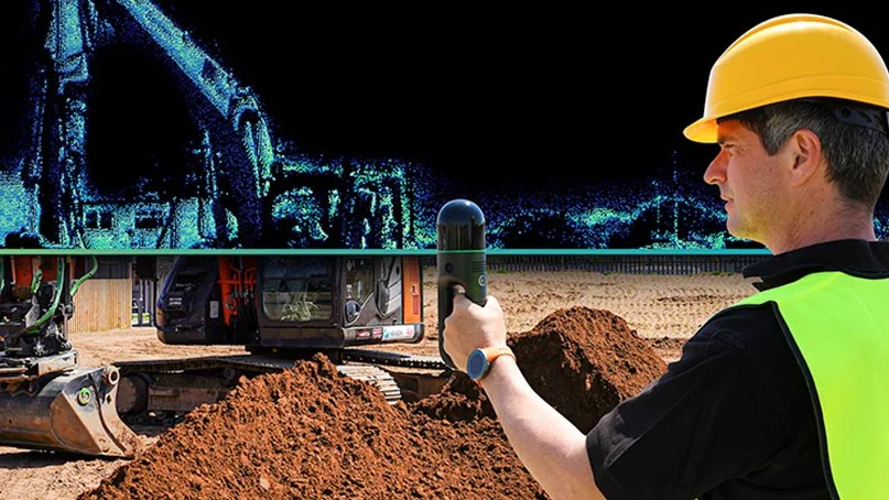
Professional-grade laser scanners — the kind used in Scan-to-BIM and as-built documentation — capture geometry at accuracies of 1–3mm. Consumer Matterport hardware operates at roughly ±1% of distance, which sounds small until you're trying to fit a structural beam or calculate code-compliant clearances. The difference matters enormously in renovation, fit-out, and MEP coordination work.
2. BIM-ready deliverables
A point cloud is raw data. A Revit model, a coordinated IFC file, or a set of as-built drawings is a deliverable. Scan-to-BIM is the process of converting one into the other — and it requires trained technicians who understand LOD (Level of Detail) requirements, BIM standards, and how the model will actually be used downstream. No platform automates this. It requires human expertise.
3. Professional accountability
When a structural engineer or heritage consultant commissions as-built documentation from Lightbound 3D, they're getting a deliverable they can stake their own professional work on. A self-generated Matterport scan carries no such guarantee. If the dimensions are wrong, there's no professional liable for the error.
4. Complex environments
Large floor plates, multi-storey buildings, heritage structures with irregular geometry, sites with low light or reflective surfaces — these all require scanner selection, scan registration strategy, and field expertise that a consumer app cannot replicate. Professional laser scanners use sophisticated registration algorithms across dozens of scan positions. Getting it right requires judgment, not just hardware.
5. Integrated deliverables
A specialist combines the right tools for the job: terrestrial laser scanning for large commercial spaces, Matterport for immersive client presentations, drone photogrammetry for exterior and site work. A platform locks you into one capture method and one output format.
When a platform is the right choice
To be clear: self-serve platforms have their place. If you need:
A basic virtual walkthrough for a residential listing
Internal condition documentation with no design or engineering downstream
A quick visual reference that doesn't need to be dimensionally accurate
A simple space hosted and shared online affordably
...then a Matterport camera and a monthly subscription may be all you need. We won't pretend otherwise.
When you need a specialist
Hire a 3D scanning specialist when:
You need accurate as-built dimensions for design, renovation, or construction
Your deliverable is a BIM model, CAD drawing, or set of as-built plans
The project involves complex geometry, multiple floors, or large square footage
Your downstream team (architect, engineer, contractor) needs data they can build on
You need drone integration, exterior capture, or multi-method documentation
There is professional liability attached to the accuracy of the deliverable
You need fast turnaround with guaranteed quality — not trial and error
The Toronto market context
In the GTA's competitive construction and real estate market, the cost of an inaccurate as-built model shows up quickly — in RFIs, change orders, and coordination failures that cost far more than the original scan. Professional 3D scanning from $1,500 is one of the highest-ROI investments on any renovation or fit-out project when the alternative is a costly field measurement error mid-construction.
For real estate, Lightbound's Matterport virtual tours start at $249 — a specialist-produced result that includes professional scan registration, properly hosted tours, and full floor plan integration. The comparison to a self-managed platform setup isn't just quality — it's time.
Questions? We're happy to discuss your specific project.
Lightbound 3D serves architects, engineers, developers, property managers, and real estate professionals across Toronto and the GTA. If you're weighing your options, contact us at hello@lightbound3d.com or (437) 775-9000 and we'll give you a straight answer about what makes sense for your project.

How Much Does 3D Scanning Cost in Toronto?
3D laser scanning in Toronto starts at $1,500. Learn what affects pricing, what's included, and how scanning compares to traditional surveying for construction, renovation, and facility management projects.
Author: Jonas Lood, Lightbound 3D
3D laser scanning in Toronto starts at $1,500 for a standard commercial engagement. But the total cost of a scanning project depends on several factors — building size, number of floors, site complexity, and what deliverables you need. A simple Matterport virtual tour of a residential listing costs $249. A full LiDAR scan with Scan to BIM modeling for a commercial renovation can run $3,500 to $10,000 or more. This guide breaks down exactly what each type of 3D scanning costs so you can budget your project accurately.
Types of 3D Scanning and What They Cost
Not all 3D scanning is the same. The term covers a range of technologies and services, each suited to different applications and priced accordingly.
Matterport 3D scanning uses a specialized camera to create photorealistic, navigable virtual tours. It's fast, affordable, and ideal for real estate marketing, facility documentation, and visual walkthroughs. Matterport scanning starts at $249 for a virtual tour, or $349 with floor plans included.
LiDAR laser scanning uses survey-grade instruments to capture millions of precise measurement points, producing a point cloud with millimetre-level accuracy. This is the technology used for renovation design, construction documentation, and engineering projects where dimensional accuracy is critical. LiDAR scanning starts at $1,500.
Scan to BIM takes the laser scan data and converts it into an intelligent 3D model in Revit — with defined walls, floors, ceilings, structural elements, and MEP systems. This is the deliverable architects, engineers, and contractors work with directly. Scan to BIM modeling starts at $2,000.
3D Scanning Price Breakdown
Here's what each service costs at Lightbound 3D in 2026:
Matterport 3D Virtual Tour — $249. Includes a complete interactive 3D walkthrough hosted online.
Matterport 3D Virtual Tour + Floor Plan — $349. Adds a schematic floor plan with room dimensions.
Interactive Listing Package — $679. Bundles a Matterport tour, floor plans, and professional photography in one package.
3D Laser Scanning — from $1,500. High-accuracy LiDAR scanning with point cloud delivery in .rcp, .e57, and .las formats.
Scan to BIM Modeling — from $2,000. Converts point cloud data into a Revit BIM model at LOD 200. LOD 300 and LOD 400 available on request.
Aerial Drone Panorama — $189. Single aerial panorama photograph.
Drone Photography Pro — $629. Comprehensive aerial photography package with up to 15 professional images.
Real Estate and Architectural Photography — $529. Professional HDR photography for interiors and exteriors.
Virtual Staging — $425 per room. Photorealistic digital furnishing of empty rooms.
Space Hosting — $9.99 per month. Cloud hosting to keep Matterport virtual tours live and accessible.
What Factors Affect 3D Scanning Cost?
Several variables determine the final cost of a laser scanning engagement beyond the base price.
Building size is the most significant factor. A 5,000 SF retail space requires fewer scan positions and less processing time than a 50,000 SF commercial office floor. Pricing scales with the area being scanned, though not linearly — larger projects benefit from efficiencies in setup and registration.
Number of floors multiplies the scanning scope. A single-floor scan is straightforward. A multi-storey building requires scanning each level, stairwells, and vertical connections, plus additional registration time to align the scans across floors.
Site complexity matters. A wide-open warehouse with clear sightlines scans quickly. A hospital with hundreds of rooms, narrow corridors, and dense MEP infrastructure above the ceiling takes significantly more time. Spaces with restricted access, hazardous materials, or operational constraints that limit scanning windows also affect pricing.
Deliverable requirements drive cost. A point cloud alone is less expensive than a full Scan to BIM model. An architectural-only BIM model at LOD 200 costs less than a comprehensive model including MEP systems at LOD 300 or LOD 400. The level of detail you need determines how much post-processing and modeling time is required.
Travel distance can be a factor. Projects within the GTA are included in standard pricing. Projects outside the Greater Toronto Area — such as our work in Muskoka, Peterborough, and other parts of Ontario — may include a travel surcharge depending on distance.
3D Scanning vs. Traditional Surveying: Cost Comparison
Traditional manual surveying for a commercial floor plate typically costs $3,000 to $8,000 depending on building complexity, and takes three to five days of on-site measurement followed by weeks of CAD drafting. Accuracy is generally within half an inch to an inch.
3D laser scanning captures the same floor in hours rather than days, with accuracy within 1–2 millimetres. While the scanning itself is faster and often less expensive than traditional surveying, the real cost savings come downstream — fewer site revisits, fewer design conflicts during construction, and less rework caused by inaccurate existing conditions documentation.
For renovation projects, the cost difference is particularly meaningful. An inaccurate survey that leads to a single mechanical clash during construction can cost tens of thousands of dollars to resolve in the field. A $3,500 scan and BIM model that prevents that clash pays for itself many times over.
Typical Project Cost Examples
To give you a practical sense of what projects cost, here are examples based on real engagements Lightbound 3D has completed across Ontario.
A residential real estate listing requiring a Matterport virtual tour and floor plans typically costs $349 — a single visit with same-week delivery.
A commercial office floor plate of 15,000 SF requiring a laser scan and LOD 200 Revit model typically costs $4,000 to $6,000 depending on MEP complexity.
A multi-storey mixed-use building requiring full architectural and MEP documentation across three floors might cost $12,000 to $18,000 for the complete scan and BIM package.
A multi-location facilities management program — like documenting every location for a restaurant chain expanding across Ontario — is typically priced on a per-location basis with volume discounts, making each individual scan more cost-effective as the program scales.
A custom residential estate of 25,000 SF requiring laser scanning, Scan to BIM, Matterport virtual tour, and as-built documentation represents a comprehensive engagement priced based on the full scope of deliverables.
How to Get a Quote
For Matterport virtual tours, photography, virtual staging, and standard listing packages, you can order directly from our online catalogue at fixed prices — no sales call required.
For 3D laser scanning and Scan to BIM projects, pricing is project-specific. The fastest way to get an accurate quote is to tell us the building type, approximate square footage, number of floors, and what deliverables you need. We'll typically have a quote back to you within 24 hours.
Contact us at 437-775-9000 or submit a request through our website.
Frequently Asked Questions
How much does 3D scanning cost in Toronto? 3D laser scanning starts at $1,500 at Lightbound 3D. A Matterport 3D virtual tour starts at $249. Total project cost depends on building size, complexity, and deliverable requirements. A typical commercial floor plate with scan and BIM model costs $3,500 to $6,000.
What is the difference between Matterport scanning and laser scanning? Matterport creates photorealistic virtual tours for marketing and visual documentation starting at $249. Laser scanning captures millimetre-accurate measurement data for renovation design and construction starting at $1,500. They serve different purposes and can both be captured in a single site visit.
Is 3D scanning cheaper than traditional surveying? The scanning itself is often comparable in cost, but the overall project savings are significant. 3D scanning is faster, more accurate, and reduces downstream costs from design conflicts and construction rework. A floor that takes a survey team three to five days to measure manually can be scanned in hours.
What deliverables are included in a 3D scanning project? Standard deliverables include registered point cloud data in .rcp, .e57, or .las formats. Scan to BIM projects add a Revit model at the specified LOD. Additional deliverables can include 2D CAD floor plans, sections, elevations, and Matterport virtual tours.
Ready to Get Started?
You can order Matterport virtual tours, photography, and listing packages directly from our online catalogue. For 3D laser scanning and Scan to BIM quotes, contact us with your project details.
Order Now | Learn More About Our 3D Scanning Services | Learn More About Our Scan to BIM Services | Learn More About Our Matterport Services | Explore Our Projects

How Much Does Virtual Staging Cost in Toronto?
Virtual staging in Toronto costs $425 per room compared to $3,000–$8,000+ for physical staging. Learn what's included, how it works, and when it's the right choice for your real estate listing.
Author: Jonas Lood, Lightbound 3D
Virtual staging in Toronto costs $425 per room at Lightbound 3D — a flat rate with no hidden fees. Compared to physical staging, which typically runs $3,000 to $8,000 or more for a full home in the Toronto market, virtual staging delivers comparable visual impact at a fraction of the cost. This guide breaks down what's included, how pricing works, and when virtual staging is the right choice for your listing.
What Is Virtual Staging?
Virtual staging is the process of digitally furnishing empty rooms using photorealistic 3D rendering. A professional photographer captures high-resolution images of the vacant space, and our design team digitally adds furniture, decor, lighting, and accessories to create listing-ready photos that show buyers how the space could look when furnished.
The result is indistinguishable from a professionally staged room in listing photos. Buyers scrolling through MLS listings see a warm, inviting space rather than empty walls and bare floors — which makes a significant difference in click-through rates and showing requests.
Virtual Staging Pricing in Toronto
At Lightbound 3D, virtual staging is $425 per room. This is a flat rate that includes professional photography of the empty space, photorealistic digital furniture and decor placement, two rounds of revisions, and final delivery of high-resolution listing-ready images.
There are no per-image charges, no setup fees, and no minimum room requirements. You can stage one room or ten — the price per room stays the same.
Virtual Staging vs. Physical Staging: Cost Comparison
The cost difference between virtual and physical staging is substantial, especially in the Toronto market where physical staging companies charge premium rates.
Physical staging for a typical Toronto home costs $3,000 to $8,000 or more depending on the size of the home, the quality of the furniture, and the rental duration. Most physical staging companies charge a monthly rental fee — if the property takes longer to sell, the costs keep accumulating. Delivery, setup, and removal are additional charges on top of the furniture rental.
Virtual staging at $425 per room eliminates all of those variable costs. A three-bedroom home with a living room and dining area staged virtually costs roughly $2,125 total — with no ongoing rental fees, no delivery logistics, and no risk of furniture damage. The staged photos are yours permanently and can be used across MLS, social media, print marketing, and virtual tour platforms.
When Virtual Staging Makes Sense
Virtual staging is the right choice in several common scenarios. Vacant properties benefit the most — empty rooms photograph poorly and make it difficult for buyers to visualize the space. Investment properties and flips where the owner wants to minimize carrying costs are ideal candidates. Pre-construction and new development marketing often uses virtual staging to show model suite concepts before the units are finished. And properties in the luxury segment where physical staging costs would be disproportionately high can achieve the same visual impact virtually.
Virtual staging is less suitable when buyers will be visiting the property in person and expecting to see the furniture shown in the listing photos. In those cases, physical staging may be worth the investment, or a combination of virtual staging for online marketing and minimal physical staging for key rooms can be an effective hybrid approach.
What Rooms Should You Stage?
Not every room needs staging to make an impact. The highest-return rooms to stage are the living room, master bedroom, and kitchen or dining area — these are the rooms buyers focus on most when browsing listings online. Staging these three rooms typically costs $1,275 at our flat rate and creates enough visual warmth to carry the entire listing.
Secondary bedrooms, home offices, and outdoor spaces can also be staged, but prioritize the rooms that appear in the first five photos of the listing — that's where most buyers make their decision to book a showing or keep scrolling.
How the Virtual Staging Process Works
The process is straightforward. First, we photograph the empty rooms using professional HDR photography to capture accurate colours, lighting, and spatial dimensions. Next, our design team selects furniture and decor styles appropriate to the property type and target buyer demographic — modern for downtown condos, transitional for suburban homes, contemporary for new builds. The digital furniture is rendered into the photos with accurate perspective, lighting, and shadows.
You receive a first draft within a few business days. Two rounds of revisions are included if you want to swap furniture pieces, adjust the layout, or change the style direction. Final images are delivered in high resolution, ready for MLS, print, and digital marketing.
Virtual Staging and Matterport Virtual Tours
Virtual staging can be combined with a Matterport 3D virtual tour for a complete digital listing package. While the virtual staging creates beautiful still images for MLS and marketing, the Matterport tour gives buyers an immersive, interactive walkthrough of the actual space.
At Lightbound 3D, we offer both services and can capture everything in a single site visit. A Matterport virtual tour starts at $249, or $349 with floor plans. Combined with virtual staging, you get a comprehensive digital marketing package that covers every touchpoint in the buyer's online journey.
Our Interactive Listing Package bundles a Matterport tour, floor plans, and professional photography for $679 — add virtual staging to individual rooms as needed.
Frequently Asked Questions
How much does virtual staging cost in Toronto? Virtual staging costs $425 per room at Lightbound 3D. This is a flat rate that includes professional photography, photorealistic digital furnishing, two rounds of revisions, and high-resolution listing-ready images.
Is virtual staging as effective as physical staging? For online marketing, yes. Studies consistently show that staged homes — whether physically or virtually — sell faster and for higher prices than vacant properties. Virtual staging is particularly effective for MLS listings and social media marketing where buyers are viewing photos on screens.
How long does virtual staging take? You receive a first draft within a few business days of the photo shoot. Two rounds of revisions are included, and final images are typically delivered within one week of the initial appointment.
Can I combine virtual staging with a Matterport tour? Yes. Lightbound 3D offers both virtual staging and Matterport virtual tours, and both can be captured in a single site visit. A Matterport tour starts at $249, and our Interactive Listing Package bundles a tour, floor plans, and photography for $349.
Ready to Stage Your Listing?
You can order virtual staging directly from our online catalogue — no sales call required. We serve real estate agents and property owners across Toronto, Mississauga, and the Greater Toronto Area.
Order Virtual Staging Now | Learn More About Our Virtual Staging Services | Explore Our Projects
Digital Twins for Real Estate: What Property Owners Need to Know
A digital twin is a living 3D replica of your property built from scan data. Learn how real estate owners in Toronto are using digital twins for facility management, leasing, and renovation planning.
Author: Jonas Lood, Lightbound 3D
A digital twin is a virtual replica of a physical property — a 3D model built from real scan data that mirrors the actual building in its current condition. For real estate owners and property managers in Toronto and the GTA, digital twins are becoming an essential tool for managing assets more efficiently, marketing spaces more effectively, and planning renovations with greater accuracy.
Unlike static floor plans or architectural drawings that go out of date the moment a tenant modifies their space, a digital twin is a living document that can be updated as the building changes. It gives you a single, accurate, visual record of your property that your entire team — from facility managers to leasing agents to design consultants — can access from anywhere.
What Is a Digital Twin in Real Estate?
In real estate, a digital twin is a three-dimensional model of a building created from physical scan data — typically captured using Matterport 3D cameras, LiDAR laser scanners, or both. The model represents the property as it actually exists today, including room layouts, finishes, ceiling heights, structural elements, and in some cases mechanical and electrical systems.
The digital twin can take different forms depending on the use case. A Matterport 3D virtual tour provides an immersive, navigable walkthrough that anyone can explore from a web browser — ideal for leasing, marketing, and remote property inspection. A point cloud captured by laser scanning provides millimetre-accurate measurement data for renovation design and construction planning. And a BIM model in Revit converts that scan data into an intelligent 3D model with defined building elements for architects and engineers.
These aren't separate products competing with each other — they're layers of the same digital twin, each serving a different audience and purpose within the property lifecycle.
How Property Owners Are Using Digital Twins in Toronto
Toronto's commercial real estate market is one of the most active in North America, with constant tenant turnover, building repositioning, and capital improvement programs. Digital twins are helping property owners navigate this activity more efficiently in several ways.
Facility management teams use digital twins to conduct remote property inspections, plan maintenance work, and document building conditions without dispatching staff to every site. When a property manager needs to check a ceiling tile condition or verify a mechanical room layout, they can walk through the space virtually instead of driving across the city.
Leasing teams use Matterport virtual tours to market vacant spaces to prospective tenants anywhere in the world. A tenant in Calgary evaluating a sublease opportunity on King Street can tour the floor plate from their laptop, assess the layout and finishes, and decide whether to fly in for a showing — dramatically reducing the number of unproductive site visits.
Renovation planning benefits from the accuracy of laser-scanned digital twins. When an architect needs existing conditions documentation for a tenant improvement or base building upgrade, the scan data provides a precise starting point for design — eliminating weeks of manual measurement and reducing the risk of costly field conflicts during construction.
Insurance and compliance documentation is simplified with a digital twin on file. Building owners can provide insurers with a comprehensive visual record of property conditions, and compliance teams can reference the model for code and accessibility reviews without scheduling a site visit.
Matterport vs. Laser Scanning: Which Creates the Right Digital Twin?
The right approach depends on what you need the digital twin for.
Matterport 3D scanning is ideal for visual documentation, virtual tours, floor plans, and marketing. The camera captures a photorealistic 3D model that anyone can walk through in a web browser. It's fast, affordable, and perfect for leasing presentations, tenant onboarding, and general facility documentation. A standard Matterport scan starts at $249 for a virtual tour or $349 with floor plans.
3D laser scanning with LiDAR produces survey-grade measurement data with millimetre accuracy. This is the right choice when the digital twin will be used for renovation design, Scan to BIM modeling, structural analysis, or any application requiring precise dimensional data. Laser scanning starts at $1,500, with Scan to BIM modeling starting at $2,000.
Many property owners use both. A Matterport tour serves the leasing and facility management teams, while a laser scan and BIM model serve the design and construction teams.
At Lightbound 3D, we call this combined deliverable BIM+ — our methodology pairing a Revit BIM model with a Matterport virtual tour, both captured in a single site visit. The technical team works in the model. Everyone else — property managers, leasing brokers, asset owners — works in the tour. Both reflect the same physical reality because both came from the same scan.
Digital Twins for Multi-Property Portfolios
The value of digital twins multiplies across a portfolio. When you have a standardized digital twin for every property in your portfolio, your operations team can compare spaces, plan capital improvements across buildings, and make portfolio-level decisions using consistent, up-to-date data.
Lightbound 3D works with multi-location operators across Ontario — including restaurant chains that have documented every new location as they expanded across southern Ontario. Each property's digital twin is captured to the same standard, creating a growing library of consistent building documentation that the corporate facilities team accesses remotely for maintenance planning, brand compliance reviews, and renovation scoping.
This approach works equally well for commercial office portfolios, retail chains, multi-residential buildings, and institutional owners managing dozens or hundreds of properties across the GTA.
What Does a Digital Twin Cost?
Digital twin pricing depends on the scope — specifically, which layers of the digital twin you need.
For a Matterport-based digital twin with a virtual tour and floor plans, pricing starts at $349 per space. This covers the visual layer — an interactive 3D walkthrough with dimensioned floor plans that serves leasing, marketing, and general facility documentation needs.
For a scan-grade digital twin with laser scanning and BIM modeling, pricing starts at $1,500 for the scan and $2,000 for the Revit model. This covers the precision layer — survey-accurate point cloud data and intelligent BIM models for renovation design and construction planning.
Ongoing hosting for Matterport virtual tours is $9.99 per month per space.
For multi-property portfolios, we provide volume pricing and can structure ongoing scanning programs on a per-project or retainer basis. Contact us at 437-775-9000 for a custom quote.
Getting Started with a Digital Twin
Creating a digital twin starts with a single scan. You don't need to digitize your entire portfolio at once — most property owners start with one building or one floor and expand from there as they see the value.
The process is straightforward. We visit the property, capture the space using Matterport and/or laser scanning depending on your needs, and deliver the finished digital twin within days. Your team can access the virtual tour immediately from any device, and BIM deliverables follow within one to two weeks depending on project complexity.
If you're not sure which approach is right for your property, we're happy to walk you through the options based on your specific use case.
Frequently Asked Questions
What is a digital twin in real estate? A digital twin is a virtual 3D replica of a physical property, built from Matterport or laser scan data. It represents the building as it actually exists today and can be used for facility management, leasing, renovation planning, and building documentation.
How much does a digital twin cost for a commercial property? A Matterport-based digital twin with a virtual tour and floor plans starts at $349. A laser-scanned digital twin combines 3D laser scanning (from $1,500) with Scan-to-BIM modeling (from $2,000) — a typical commercial floor plate package starts around $3,500. Pricing depends on building size, complexity, and the level of detail required.
Can a digital twin be updated? Yes. Digital twins can be rescanned and updated whenever the building undergoes significant changes — tenant improvements, renovations, or system upgrades. Many property owners schedule periodic rescans to keep their digital twin current.
What is the difference between a Matterport tour and a laser scan? A Matterport tour creates a photorealistic, navigable 3D walkthrough ideal for marketing and visual documentation. A laser scan captures millimetre-accurate measurement data suitable for renovation design, BIM modeling, and construction planning. Both can be captured in a single site visit.
Ready to Create a Digital Twin of Your Property?
Whether you manage a single building or a multi-property portfolio, Lightbound 3D delivers digital twin solutions that help you manage, market, and improve your real estate assets. We serve property owners, facility managers, and commercial real estate teams across Toronto and the Greater Toronto Area.
Order Now | Learn More About Our Matterport Services | Learn More About Our 3D Scanning Services | Explore Our Projects

What is Scan-to-BIM? A Complete Guide
Scan to BIM converts 3D laser scan data into accurate Revit BIM models. Learn how the process works, what it costs, and why architects, engineers, and contractors across Toronto rely on it.
Author: Jonas Lood, Lightbound 3D
Scan to BIM is the process of converting 3D laser scan data into an intelligent Building Information Model (BIM) — typically a Revit model that architects, engineers, and contractors can use for renovation design, construction planning, and facility management. Instead of sending a team with tape measures to manually document a building, you scan the space with a LiDAR scanner, capture millions of precise data points, and then model the building digitally from that data.
The result is a dimensionally accurate 3D model of the building as it actually exists — not as it was originally designed, but as it stands today, including every modification, renovation, and field change made over the building's lifetime.
How the Scan to BIM Process Works
The process has three stages. First, a field team captures the physical space using a 3D laser scanner. The scanner emits laser pulses that measure the distance to every surface in the room, recording millions of individual data points per scan position. Multiple scan positions are registered together to create a complete three-dimensional point cloud of the entire building or floor.
Second, the raw point cloud data is processed and cleaned. This involves removing noise, aligning scan positions, and producing a unified dataset that accurately represents the space.
Third, BIM technicians use the point cloud as a reference to build an intelligent 3D model in Revit. They trace walls, floors, ceilings, doors, windows, structural elements, and MEP systems directly from the scan data, creating a model that reflects the true dimensions and spatial relationships of the building. The finished model includes not just geometry but information — wall types, material properties, system classifications, and spatial data that makes the model useful for design, analysis, and coordination.
Point Cloud to BIM: Understanding the Data
The point cloud is the foundation of every Scan to BIM project. It's a dataset containing millions — sometimes billions — of individual measurement points, each with an X, Y, Z coordinate and often colour information captured from photographs taken during the scan.
When you hear the term "point cloud to BIM," it describes the same process as Scan to BIM — converting this raw measurement data into a structured, intelligent Revit model. The point cloud itself is delivered in standard formats such as .rcp (Autodesk ReCap), .e57, or .las, and can be loaded directly into Revit, AutoCAD, or Navisworks as a visual reference alongside the modelled elements.
Point clouds are highly accurate — typically within 1–2 millimetres — which means the BIM model built from them is far more dimensionally precise than anything produced from manual measurement.
Levels of Detail (LOD) in Scan to BIM
Not every project requires the same level of modelling detail. The industry uses a standardized LOD scale to define how much information the BIM model should contain.
LOD 200 is the most common level for Scan to BIM projects. It includes the basic geometry of architectural elements — walls, floors, ceilings, doors, windows, and columns — with approximate dimensions and locations. This level is sufficient for most renovation planning, space analysis, and general facility documentation.
LOD 300 adds precise dimensions, accurate material representations, and detailed connections between elements. This level supports detailed design development and construction documentation.
LOD 400 includes fabrication-level detail — exact sizes, shapes, and connections suitable for manufacturing and construction coordination. This level is typically required for complex MEP coordination and prefabrication work.
At Lightbound 3D, standard Scan to BIM projects include LOD 200 modelling, with LOD 300 and LOD 400 available on request based on project requirements.
Who Uses Scan to BIM?
Scan to BIM serves a wide range of professionals in the architecture, engineering, and construction (AEC) industry. Architects use Scan to BIM models as the starting point for renovation and adaptive reuse design — having an accurate existing conditions model in Revit eliminates weeks of manual documentation and reduces the risk of design conflicts during construction. Structural engineers rely on scan data to verify existing structural conditions before designing additions, modifications, or seismic upgrades.
MEP engineers use Scan to BIM to map existing mechanical, electrical, and plumbing systems before designing new installations — critical for avoiding clashes in renovation projects where existing routing is hidden above ceilings or behind walls. General contractors use the models for accurate scope estimation, construction sequencing, and trade coordination. And facility managers use Scan to BIM models as a living digital record of their building, supporting ongoing maintenance, space planning, and capital improvement projects.
In Toronto's commercial real estate market, Scan to BIM is increasingly standard practice for any significant renovation or repositioning project. Older buildings with decades of undocumented modifications benefit enormously from the accuracy and completeness of scan-based documentation.
Scan to BIM vs. Traditional Surveying
Traditional building surveying relies on manual measurement — tape measures, laser distance meters, and hand-drawn field sketches that are later drafted into CAD drawings. This approach is time-consuming, labour-intensive, and limited in accuracy. A typical commercial floor plate might take a survey team three to five days to measure manually, with accuracy in the range of half an inch to an inch.
3D laser scanning captures the same floor in hours rather than days, with accuracy within 1–2 millimetres. The point cloud also captures details that manual surveyors typically miss or simplify — ceiling heights, structural connections, pipe routing, and spatial relationships that are difficult to measure by hand but are automatically recorded by the scanner.
The speed and accuracy difference translates directly into cost savings for the overall project. Faster documentation means less disruption to occupied buildings. Higher accuracy means fewer surprises during construction. And having a complete point cloud on file means the building can be re-examined digitally at any time without returning to the site.
How Much Does Scan to BIM Cost in Toronto?
Scan to BIM pricing depends on building size, complexity, and the level of detail required. At Lightbound 3D, 3D laser scanning starts at $1,500 and Scan to BIM modelling starts at $2,000. A typical commercial floor plate of 10,000 to 20,000 square feet at LOD 200 might cost $3,500 to $6,000 for the complete scan and model package, depending on the complexity of the space and the number of MEP systems to be documented.
Factors that affect pricing include the number of floors, ceiling heights, accessibility of spaces, the density of MEP systems, and whether the modelling scope includes architectural only or full architectural plus MEP. Multi-floor or multi-building projects are typically quoted on a per-project basis.
For a detailed quote based on your specific project, contact us at 437-775-9000 or request a quote through our website.
Common Scan to BIM Deliverables
A typical Scan to BIM engagement produces several deliverables. The Revit BIM model (.rvt) is the primary output — a fully modelled 3D representation of the existing building that can be used directly by design teams. Point cloud data is delivered in .rcp, .e57, or .las formats for teams that want access to the raw scan data. 2D floor plans, sections, and elevations can be extracted from the Revit model and delivered as .dwg (AutoCAD) or PDF files. And a Matterport 3D virtual tour can be captured during the same site visit if visual documentation is also needed.
Beyond Scan-to-BIM: The BIM+ Approach
Scan-to-BIM gives the design team a Revit model. But a Revit model only serves the people on the project team who can open it — typically just the architects, engineers, and contractors. That's the gap BIM+ is built to close.
BIM+ is our methodology pairing Revit precision with Matterport accessibility. On every Scan-to-BIM project we deliver, we capture a Matterport virtual tour of the same space in the same site visit. The BIM model serves the technical team. The Matterport tour serves everyone else on the project — leasing brokers, property managers, operations leads, asset owners — who can walk through the space in their browser without specialised software.
One source of truth. Two interfaces. Both reflect the same physical reality because both came from the same scan.
For Toronto commercial projects where the people making business decisions are different from the people making design decisions, BIM+ is the difference between a deliverable that sits with the design team and one that gets used across the entire project lifecycle.
Frequently Asked Questions
What is Scan to BIM? Scan to BIM is the process of converting 3D laser scan data into an accurate Building Information Model in Revit. The building is scanned with a LiDAR scanner to create a point cloud, which is then used to model walls, floors, ceilings, structural elements, and MEP systems in three dimensions.
How much does Scan to BIM cost? At Lightbound 3D in Toronto, 3D laser scanning starts at $1,500 and Scan to BIM modeling starts at $2,000. A typical commercial floor plate costs $3,500 to $6,000 for the complete scan and model package depending on size and complexity.
What is the difference between point cloud and BIM? A point cloud is raw measurement data — millions of individual 3D coordinate points captured by a laser scanner. A BIM model is an intelligent 3D model built from that data in Revit, with defined elements like walls, doors, and MEP systems that contain information about their properties and relationships.
What LOD is standard for Scan to BIM? LOD 200 is the most common level of detail for Scan to BIM projects. It includes the basic geometry of architectural elements with approximate dimensions. LOD 300 and LOD 400 are available for projects requiring greater precision or fabrication-level detail.
Ready to Start Your Scan to BIM Project?
Whether you need an existing conditions model for a renovation, as-built documentation for facility management, or a complete point cloud of your building, Lightbound 3D delivers accurate Scan to BIM services across Toronto and the Greater Toronto Area.
Order Now | Learn More About Our Scan-to-BIM Services | Learn More About Our 3D Scanning Services | See Our Scan-to-BIM Project — Custom Estate, Kleinburg
How Digital Twins Are Reshaping Commercial Property Management in Toronto and the GTA
Toronto's commercial property market is shifting fast, and the buildings that are leasing fastest have one thing in common: better data. This report examines how digital twin technology is helping property managers across the GTA reduce operating costs, meet the City's new energy reporting requirements, and retain tenants in an increasingly competitive market.
By Jonas Lood, Lightbound 3D | February 2026
Toronto's commercial real estate market is at an inflection point. Downtown office vacancy rates hovered near 13% at the close of 2025, down from a peak of almost 15% the year before, while suburban markets recorded their first annual net absorption gain since 2019. Industrial vacancy across the GTA sits at roughly 3.2%, tight by national standards, yet the highest it's been since 2015. Tenants are more selective than ever, gravitating toward trophy and Class A spaces that offer modern amenities, strong ESG credentials, and responsive management.
For property managers and building owners navigating this market, the question is no longer whether to modernize operations. It's how quickly you can do it. That's where digital twin technology comes in.
A digital twin is a virtual replica of a physical property, built from 3D scanning data and continuously enriched with information from sensors, building systems, and operational records. It gives you a living, data-driven model of your asset that supports faster decisions, lower costs, and better tenant outcomes.
Why Toronto Property Managers Need Better Visibility
The Toronto and GTA commercial market has changed dramatically since 2020. Vacancy has risen, tenant expectations have shifted, and the economic environment, shaped by interest rate adjustments, trade uncertainty, and return-to-office mandates from major employers like Canada's Big Five banks, has made strategic property management more important than ever.
In a market where tenants prioritize quality, landlords who have invested in their buildings, whether through upgraded lobbies, conference centres, or improved common areas, are the ones maintaining strong occupancy. CBRE's 2025 outlook noted that the trend for this year is investing in buildings, because those are the features tenants expect when touring space. The challenge is knowing where to invest, when to invest, and how to demonstrate that investment to prospects and existing tenants.
A digital twin provides that visibility. Instead of relying on outdated floor plans, static maintenance logs, and fragmented spreadsheets, property managers can access a comprehensive, real-time digital model that shows exactly how a building is performing and how its spaces are being used.
Controlling Costs in a Compressed-Margin Environment
Operating expenses are one of the biggest pressure points for commercial property owners in the GTA right now. Energy costs, maintenance labour, and insurance premiums have all risen, while rental rate growth has moderated. GTA industrial rents, for example, softened from a peak of $18.35 to $17.18 per square foot. Office landlords in fringe downtown submarkets are offering increased incentives just to attract and retain tenants.
Digital twins offer a meaningful path to reducing those expenses. Industry research shows the technology can help reduce operating costs by up to 35% and extend equipment lifespans by 15 to 20%. Predictive maintenance alone, replacing reactive, break-fix approaches with data-driven service scheduling, has been shown to cut maintenance expenses by 8 to 30% depending on the building's age and systems.
Key finding: Digital twins can help reduce operating costs by up to 35% and extend equipment lifespans by 15 to 20%.
For a GTA property manager overseeing multiple assets, the practical impact is significant. Real-time energy monitoring identifies inefficiencies. An HVAC unit drawing more power than it should, lighting running in unoccupied zones, heating schedules misaligned with actual tenant usage. These are the kinds of waste that add up silently across a portfolio and that a digital twin makes immediately visible and actionable.
Meeting Toronto's Mandatory Reporting and Sustainability Requirements
This isn't just about competitive advantage. It's increasingly about compliance. The City of Toronto's Energy and Water Reporting Bylaw now requires owners of buildings 50,000 square feet and larger to report their energy and water usage annually. Buildings 10,000 square feet and larger will be subject to the same requirements by 2027. Existing buildings account for 55% of Toronto's total greenhouse gas emissions, and the City is actively developing mandatory Building Emissions Performance Standards (BEPS) to drive that number down.
Non-compliance can result in fines of up to $100,000. But beyond penalties, reporting is becoming a factor in how tenants, investors, and lenders evaluate properties. Tenants, particularly larger corporate occupiers following return-to-office mandates, are prioritizing ESG-compliant spaces. According to industry analysis, up to 83% of recent downtown leasing activity has gone to premium, amenity-rich assets. Sustainability credentials are part of what defines "premium" in today's market.
A digital twin simplifies compliance by consolidating energy, water, and emissions data into a single platform. Rather than scrambling to compile reports from disparate utility accounts and building management systems, property teams can generate accurate, audit-ready data from one source. More importantly, that same data helps identify where to make improvements, turning a compliance obligation into an opportunity to reduce costs and attract higher-quality tenants.
Strengthening Tenant Retention Through Proactive Management
In a market with elevated vacancy, retaining good tenants is as important as attracting new ones. Tenants want spaces that are reliable, comfortable, and well-managed, and they notice when their building falls short. An HVAC system that can't maintain consistent temperatures, a recurring plumbing issue that never fully gets resolved, common areas that feel dated. These are the friction points that drive turnover.
Digital twins shift property management from reactive to proactive. By tracking equipment performance and environmental conditions in real time, managers can identify and resolve issues before tenants feel the impact. An air handling unit showing early signs of decline gets serviced before it fails on a hot July afternoon. Occupancy data reveals that certain floors or zones are underutilized, enabling smarter HVAC and lighting adjustments that save money without compromising comfort in high-traffic areas.
This kind of responsive, data-informed management is exactly what today's GTA tenants are looking for. It builds trust, reduces complaints, and gives property teams a concrete story to tell during lease renewal conversations.
Smarter Capital Planning for a Changing Market
Toronto's commercial property landscape is evolving. Aging B and C-class office buildings are being repositioned for medical, biotech, and educational uses. Industrial corridors along the 400-series highways are expanding. Retail centres are integrating residential units, restaurants, and experiential offerings. In each of these scenarios, owners and managers face the same challenge: deciding where to allocate capital for the greatest return.
Digital twins make this easier by enabling scenario modelling. Property teams can simulate how a renovation will affect energy performance, how a change in leasing strategy might impact space utilization, or how a major system replacement will alter operating costs over time. Industry case studies have shown an average 15% reduction in capital expenditure and payback periods as short as 14 months when digital twins are used to guide investment decisions.
For properties navigating the transition from obsolete office space to higher-value uses, a particularly relevant challenge in downtown Toronto's North and East submarkets, a digital twin provides the baseline data and simulation tools needed to evaluate repositioning options with confidence rather than guesswork.
Where the Industry Is Headed
Adoption of digital twin technology in commercial real estate is accelerating. According to a Deloitte survey, approximately 15% of real estate firms have reached full production-stage adoption, with another 22% in early-stage implementation and 30% actively piloting. The digital twin market in real estate is projected to reach $13.9 billion by 2033, growing at over 14% annually.
In Toronto and the GTA, the convergence of tightening regulatory requirements, competitive leasing conditions, and a tenant market that increasingly rewards quality and sustainability makes the case for adoption particularly strong. The properties that will lead the next phase of this market, whether they're Class A office towers in the Financial Core, industrial facilities in York Region, or repositioned retail centres in the 905, will be the ones that have the best data, the clearest operational visibility, and the ability to act on both.
Start with a Scan. Build from There.
At Lightbound 3D, we help commercial property owners and managers across Toronto and the GTA build the foundation for digital twin technology, starting with high-precision 3D scanning of your properties. Whether you manage a single building or a multi-asset portfolio, our scanning services give you the accurate, detailed spatial data that every effective digital twin requires.
If you're ready to explore how better building data can help you reduce costs, strengthen tenant relationships, and stay ahead of Toronto's evolving compliance requirements, we'd welcome the conversation.
Want the full data and research behind this article?
Download our complete Industry Report with detailed market statistics, cost analysis, and full source references.
Request a Project Quote | Book a Discovery Call
Learn more about our 3D Scanning and BIM Services
What We Learned Capturing 2 Million Square Feet of Toronto Commercial Real Estate
Lightbound 3D scanned over 2 million square feet of Toronto commercial real estate in 2024 — working with property owners, operators, and flex-space providers. What we learned about bad data, scaling beyond design-bid-build, and the BIM+ approach that pairs Revit precision with Matterport accessibility.
By Jonas Lood, Lightbound 3D | October 2024 (updated May 2026)
Over the course of 2024, Lightbound 3D scanned and documented more than 2 million square feet of commercial real estate across Toronto — working alongside property owners, operators, and flex-space providers building out office portfolios at speed. Twelve months of fieldwork across more than 200 commercial floors gave us a clear view of what works, what breaks, and where the real money gets lost in how Toronto buildings are documented today.
This is what we learned.

Toronto's commercial buildings run on bad data
The single most consistent finding across our 2024 program: the floor plans landlords hand to tenants are wrong.
We scanned more than 200 commercial floors across the GTA in 2024. Across that dataset, more than 80% of operators were working from drawings that diverged from physical reality by 5–10%. Sometimes more. This isn't an estimate or an industry benchmark — it's what we measured directly, site by site, scan by scan.
The discrepancies showed up in three places that mattered:
Rentable vs. usable square footage. Lease documents reflected one number; the laser scan reflected another. On a 15,000 SF floor at $35/SF gross, a 7% discrepancy is over $36,000 in annual lease cost. Multiplied across a portfolio and a multi-year term, the numbers get serious quickly. We saw individual operators carrying six-figure lease exposure based on plans that nobody had ever ground-truthed.
Demising walls and column locations. Tenants designing fit-outs around plans that misplaced load-bearing elements ended up with redesign costs, change orders, and schedule slippage during construction.
Mechanical and electrical routing. Most legacy floor plans don't show MEP infrastructure at all, and the ones that do are often based on the original design drawings — not the as-built reality after decades of tenant improvements.
The fix isn't complicated, but it does require treating building documentation as something that needs to be captured fresh, not inherited from a PDF the landlord's broker forwarded in 2019.
Design-bid-build doesn't scale
The traditional design-bid-build model — the framework most architecture firms still default to — was designed for one-off custom projects. It works when you have months to coordinate consultants, run bidding rounds, and iterate on a single building.
It doesn't work when you're trying to open 30, 50, or 100 sites in a year.
What we saw in 2024 was operators discovering this the hard way. Project teams spending weeks renegotiating scope with a new architectural team for each location. Bid cycles eating into rollout timelines. The same problems being solved from scratch on every site because the lessons from site #4 weren't being captured in a way that informed site #14.
The operators that scaled successfully treated office build-out as a repeatable product, not a series of bespoke design projects. That meant three things:
A standardized capture process for every site — same scanner, same registration protocol, same deliverable format, regardless of who the design team was downstream.
A documentation library that every project team could reference, so site #14 started with the lessons from sites #1–13 already embedded.
Procurement and design decisions made portfolio-wide rather than project-by-project.
The first 2 million square feet was where this approach got proven out. The next portfolio rollout, for any operator scaling in this market, starts from a fundamentally different position than it would have in 2023.
What BIM actually does at portfolio scale
BIM gets discussed a lot in the AEC industry. In our experience scaling across multiple operators in 2024, the value isn't theoretical — it's measurable in three places.
Speed to lease-up. With an accurate existing-conditions BIM model on day one of a fit-out project, design teams skip 3–6 weeks of measurement, drafting, and verification work. On a fast-rollout program, those weeks compound across every site.
Change order reduction. The single biggest cost overrun on commercial fit-outs comes from discovering site conditions that don't match the documentation. A laser scan and BIM model on file before tendering means contractors bid on accurate scope, not assumptions.
Portfolio intelligence. Once you have BIM models for every site in a portfolio captured to the same standard, comparison becomes possible — floor-plate efficiency, MEP density, lighting load, ceiling height variance. Operations teams start making capital allocation decisions based on data, not vibes.
This is the gap between BIM as a checkbox deliverable and BIM as an operating discipline. Most Toronto operators are still in the first category; the ones scaling fastest have moved to the second.
The BIM+ approach: making models accessible to non-technical stakeholders
There's a problem with how BIM models traditionally get used on commercial projects: only the architects, engineers, and contractors can actually open them. Everyone else on the project team — leasing brokers, asset managers, operations leads, the COO who needs to sign off on the rollout — is locked out by the software.
The result is a familiar pattern. Design decisions get made in Revit. Documentation lives in Revit. But the people making the business decisions are still working from PDFs, screenshots, and second-hand summaries because they don't have Autodesk licenses and shouldn't need them.
Our 2024 program is where we developed what we call the BIM+ approach: pairing every laser-scanned BIM model with a Matterport virtual tour of the same space, captured in the same site visit.
The BIM model gives the design team precision — millimetre-accurate geometry, intelligent objects, full Revit interoperability. The Matterport tour gives every other stakeholder spatial intuition — a walkable, dimensioned 3D environment they can navigate from any browser, on any device, without specialised software.
One source of truth, two interfaces. Technical teams work in the model. Everyone else works in the tour. Both reflect the same physical reality because both came from the same scan.
For multi-site operators in particular, this changed the velocity of decision-making. Leasing teams could walk prospective tenants through a space remotely. Operations leads could plan capital programs from their laptops. The COO could sanity-check a build-out without flying to Toronto. None of that is possible when the only deliverable is an .rvt file.
This is the wedge we built our practice around, and as far as we're aware, Lightbound 3D is the only firm in Toronto delivering both deliverables from a single site capture — which is what makes the BIM+ approach economically viable at portfolio scale.
What's different in 2026
We wrote the first version of this post at the end of 2024. Looking back from mid-2026, two things have shifted that reinforce the original conclusions.
First, the City of Toronto's Energy and Water Reporting Bylaw now requires every building over 50,000 SF to report energy and water usage annually, with the threshold dropping to 10,000 SF by 2027. Building owners without accurate baseline documentation are scrambling. The ones who captured comprehensive scan data in 2024 are reporting from a position of strength. (We've written more on this in How Digital Twins Are Reshaping Commercial Property Management in Toronto.)
Second, AEC labour costs and timelines have continued to tighten. The operators we worked with in 2024 who invested in upfront documentation are running 2026 expansion programs at materially lower cost per square foot than competitors who are still measuring buildings by hand.
The thesis from 2024 — that commercial space documentation needs to be treated as a scalable product, not a per-project deliverable — has only gotten stronger.
Working with Lightbound 3D
If you're managing a portfolio of Toronto commercial properties and the documentation question is on your mind, we can help. Our 2024 program scanned and documented 2 million square feet for operators across the GTA, and we work with property owners, AEC teams, and flex-space providers on programs ranging from single-floor scans to portfolio-wide rollouts.
Request a project quote | Book a discovery call| Explore our 3D scanning services| Learn about Scan-to-BIM in Toronto

Laser Measurement of the Elevator Shafts at Queens Quay Terminal
At Lightbound 3D, we’re always excited to work on projects that blend history, innovation, and technology. Our recent endeavor at the iconic Queens Quay Terminal in Toronto was no exception. This project allowed us to showcase the power of advanced laser measurement techniques in documenting complex architectural structures, specifically the elevator shafts of this historic building.
At Lightbound 3D, we’re always excited to work on projects that blend history, innovation, and technology. Our recent endeavor at the iconic Queens Quay Terminal in Toronto was no exception. This project allowed us to showcase the power of advanced laser measurement techniques in documenting complex architectural structures, specifically the elevator shafts of this historic building.
The Historical Significance of Queens Quay Terminal
Queens Quay Terminal, a landmark on Toronto’s waterfront, is not just a building; it's a piece of the city’s rich history. Originally constructed in the 1920s as a warehouse for the Toronto Harbour Commission, the building was transformed in the early 1980s into a mixed-use space that includes residential, commercial, and retail areas. The renovation preserved the building’s historical façade while introducing modern amenities, making it a unique blend of old and new.
The elevator shafts at Queens Quay Terminal are integral to the building's function, serving both residents and visitors. Given the building’s age and the complexity of its layout, capturing precise measurements of these shafts was crucial for future renovations and maintenance.
The Challenge: Documenting Complex Spaces
The project at Queens Quay Terminal presented several challenges that required meticulous planning and execution. The elevator shafts, being narrow, vertically extensive, and intricate in design, demanded a high level of accuracy in measurement. Traditional measurement methods would have been time-consuming and potentially inaccurate due to the shafts' depth and the building's complex architecture.
Our team at Lightbound 3D knew that laser measurement technology was the ideal solution for this project. We chose to utilize our advanced laser scanning equipment to capture every detail of the elevator shafts, ensuring that the data collected would be precise and comprehensive.
The Process: Harnessing Laser Measurement Technology
Laser scanning is a powerful tool in the world of building documentation, offering unparalleled accuracy and speed. For the Queens Quay Terminal project, we deployed a high-resolution laser scanner capable of capturing millions of data points per second. This technology allowed us to create a detailed point cloud of the elevator shafts, capturing even the most minute details.
The process began with a thorough survey of the building’s layout, ensuring that we could access all necessary points for scanning. Our team then strategically placed the scanner at various levels within the elevator shafts to capture the full depth and complexity of the space. Each scan was meticulously planned to ensure there was no overlap or data loss, resulting in a complete and accurate representation of the shafts.
Once the scanning was complete, we processed the data to create a 3D model of the elevator shafts. This model is not just a static image; it’s a dynamic tool that can be used for a variety of purposes, from planning future renovations to conducting structural analyses. The model can be viewed from any angle, allowing stakeholders to examine the shafts in unprecedented detail.
The Outcome: A Foundation for Future Projects
The success of the laser measurement project at Queens Quay Terminal is a testament to the capabilities of modern technology in preserving and enhancing historic structures. The data we captured will serve as a valuable resource for architects, engineers, and building managers as they plan future renovations and ensure the building's longevity.
For Lightbound 3D, this project was more than just another job—it was an opportunity to contribute to the preservation of one of Toronto’s most beloved landmarks. By using cutting-edge laser measurement technology, we were able to document the elevator shafts with a level of precision that will support the building’s upkeep for years to come.
As Toronto continues to grow and evolve, projects like this remind us of the importance of balancing innovation with preservation. At Lightbound 3D, we’re proud to be at the forefront of this effort, using technology to bridge the past and the future.
Whether it’s capturing the intricate details of an elevator shaft or documenting the full scope of a building, we’re committed to delivering accurate, high-quality results that stand the test of time. The Queens Quay Terminal project is just one example of how we’re making a difference, one scan at a time.

Lightbound 3D On Location at King and Spadina: Facade preservation with Laser Precision!
At Lightbound 3D, we are committed to using the latest technology to support construction and preservation projects across Toronto and beyond. Our work at King and Spadina is a testament to our dedication to accuracy, efficiency, and the seamless integration of new and old.
Introduction
At Lightbound 3D, we take pride in being at the forefront of advanced measurement and documentation technologies. Our latest project takes us to the bustling intersection of King and Spadina in downtown Toronto, where we are providing essential laser measurements for building shoring and architectural facade preservation at a new construction site.
The Project: Building Shoring and Facade Preservation
Building shoring and facade preservation are critical components of construction, particularly in urban environments where maintaining the structural integrity and historical value of existing buildings is paramount. Our work at this site involves:

Laser scanning and drone application to document building shoring.
Building Shoring: Ensuring that the surrounding structures are adequately supported during the excavation and construction phases.
Facade Preservation: Accurately capturing the details of the existing architectural facade to ensure it is preserved and seamlessly integrated into the new construction.
Why Laser Measurements?
Laser measurement technology offers unparalleled precision and efficiency, making it the ideal choice for complex construction projects. Here’s why:
Accuracy: Laser scanners provide highly accurate measurements, capturing minute details that are crucial for both shoring and facade preservation.
Speed: Traditional measurement methods can be time-consuming. Laser scanning dramatically reduces the time required, allowing us to deliver results faster.
Comprehensive Data: The 3D models generated from laser scans offer a comprehensive view of the site, enabling better planning and execution.
Our Process
Our process involves several key steps to ensure the highest quality results:
Initial Survey: We begin with an on-site survey to understand the specific requirements and challenges of the project.
Laser Scanning: Using state-of-the-art laser scanners, we capture detailed measurements of the building facade and the surrounding structures.
Data Processing: The data collected is processed to create accurate 3D models and detailed reports.
Integration and Planning: These models are then used to plan the shoring process and to preserve the architectural integrity of the facade.
On-Site at King and Spadina
The King and Spadina site is a hive of activity, with construction teams, heavy machinery, and our team of experts working in tandem to ensure the project’s success. Here’s a glimpse of what we’ve been up to:
Setup: Our team arrives early to set up the laser scanning equipment and conduct preliminary assessments.
Scanning: Throughout the day, we perform multiple scans from different angles to capture every detail of the facade and surrounding structures.
Collaboration: We work closely with the construction team, sharing our findings in real-time to address any immediate concerns and to adjust plans as needed.
The Impact
Our work at this site is not just about preserving a building; it's about maintaining a piece of Toronto's architectural heritage while supporting modern development. By using advanced laser measurement technology, we are able to provide precise data that ensures both safety and historical accuracy.
Conclusion
At Lightbound 3D, we are committed to using the latest technology to support construction and preservation projects across Toronto and beyond. Our work at King and Spadina is a testament to our dedication to accuracy, efficiency, and the seamless integration of new and old. Stay tuned for more updates on this exciting project and other initiatives where we continue to push the boundaries of what’s possible in building measurement and preservation.