
2025 Trends in 3D Scanning and Virtual Tour
The world of 3D scanning and virtual tours is evolving at a breakneck pace. With innovations in LiDAR, Building Information Modeling (BIM), and 3D visualization, industries like real estate, construction, and design are poised for transformative growth in 2025. Let’s dive into the trends shaping these sectors and explore how technology is redefining the way we interact with spaces.
The world of 3D scanning and virtual tours is evolving at a breakneck pace. With innovations in LiDAR, Building Information Modeling (BIM), and 3D visualization, industries like real estate, construction, and design are poised for transformative growth in 2025. Let’s dive into the trends shaping these sectors and explore how technology is redefining the way we interact with spaces.
1. Enhanced LiDAR Technology
LiDAR (Light Detection and Ranging) continues to be a cornerstone of 3D scanning, and in 2025, the technology is becoming more precise and accessible. Recent advancements in portable LiDAR devices have made it easier to capture detailed scans of environments in real time. These innovations are particularly impactful in:
Real Estate: Agents can now provide hyper-realistic 3D tours, giving prospective buyers a more immersive experience.
Construction: Contractors and architects can use LiDAR to monitor site progress and detect discrepancies in real-time, reducing costly errors.
Design: Interior designers are leveraging LiDAR to create precise digital twins of spaces, allowing for accurate planning and visualization.
2. Seamless Integration of BIM
Building Information Modeling (BIM) has been a game-changer for the construction and design industries, and its integration with 3D scanning technology is reaching new heights in 2025. Key advancements include:
Automated Updates: Scanned data can now automatically update BIM models, ensuring that digital representations are always accurate and up-to-date.
Collaboration Across Teams: Cloud-based BIM platforms enable architects, engineers, and construction teams to work together seamlessly, using real-time data from 3D scans.
Sustainability Planning: By integrating environmental data into BIM models, teams can plan for energy efficiency and sustainability from the outset.

3. Immersive Virtual Tours
Virtual tours have evolved from simple 360-degree photos to fully interactive experiences. In 2025, the integration of VR and AR technologies is revolutionizing how industries present spaces:
Real Estate: Buyers can explore properties remotely using virtual reality headsets, experiencing lifelike views of homes without stepping foot on-site.
Hospitality: Hotels and resorts are offering interactive virtual tours, allowing travelers to explore amenities and rooms before booking.
Education and Training: Virtual tours of construction sites, museums, and historical buildings are being used for training and educational purposes, enhancing accessibility and learning.
4. AI-Driven Enhancements
Artificial intelligence is increasingly being embedded in 3D scanning and visualization tools, enabling smarter, more efficient processes. Innovations include:
Automated Object Recognition: AI can identify and label objects in a scanned environment, saving time and improving accuracy.
Predictive Analytics: By analyzing scanned data, AI can predict maintenance needs in construction or identify potential design flaws.
Enhanced User Experiences: AI-driven personalization allows virtual tours to adapt to user preferences, offering tailored experiences.
5. Industry-Specific Applications
The versatility of 3D scanning and virtual tours is opening up new possibilities across various industries:
Real Estate: Shorter sales cycles and better customer engagement through interactive tours.
Construction: Improved project management with precise progress tracking and predictive insights.
Healthcare: Detailed 3D scans of facilities are aiding in hospital planning and optimizing patient flows.
Retail: Stores are creating virtual shopping experiences, blending physical and digital commerce.
Conclusion

As 2025 unfolds, the advancements in 3D scanning, LiDAR, and BIM technology are redefining industries and expanding possibilities. These tools are not just enhancing efficiency; they’re creating richer, more immersive ways to experience and interact with spaces. For businesses in real estate, construction, and design, staying ahead means embracing these innovations and integrating them into their workflows.
At Lightbound 3D, we’re excited to be part of this transformation. With years of expertise in 3D scanning and virtual documentation, we help clients bring their projects to life with precision and creativity. The future is digital—let’s build it together.

Laser Measurement of the Elevator Shafts at Queens Quay Terminal
At Lightbound 3D, we’re always excited to work on projects that blend history, innovation, and technology. Our recent endeavor at the iconic Queens Quay Terminal in Toronto was no exception. This project allowed us to showcase the power of advanced laser measurement techniques in documenting complex architectural structures, specifically the elevator shafts of this historic building.
At Lightbound 3D, we’re always excited to work on projects that blend history, innovation, and technology. Our recent endeavor at the iconic Queens Quay Terminal in Toronto was no exception. This project allowed us to showcase the power of advanced laser measurement techniques in documenting complex architectural structures, specifically the elevator shafts of this historic building.
The Historical Significance of Queens Quay Terminal
Queens Quay Terminal, a landmark on Toronto’s waterfront, is not just a building; it's a piece of the city’s rich history. Originally constructed in the 1920s as a warehouse for the Toronto Harbour Commission, the building was transformed in the early 1980s into a mixed-use space that includes residential, commercial, and retail areas. The renovation preserved the building’s historical façade while introducing modern amenities, making it a unique blend of old and new.
The elevator shafts at Queens Quay Terminal are integral to the building's function, serving both residents and visitors. Given the building’s age and the complexity of its layout, capturing precise measurements of these shafts was crucial for future renovations and maintenance.
The Challenge: Documenting Complex Spaces
The project at Queens Quay Terminal presented several challenges that required meticulous planning and execution. The elevator shafts, being narrow, vertically extensive, and intricate in design, demanded a high level of accuracy in measurement. Traditional measurement methods would have been time-consuming and potentially inaccurate due to the shafts' depth and the building's complex architecture.
Our team at Lightbound 3D knew that laser measurement technology was the ideal solution for this project. We chose to utilize our advanced laser scanning equipment to capture every detail of the elevator shafts, ensuring that the data collected would be precise and comprehensive.
The Process: Harnessing Laser Measurement Technology
Laser scanning is a powerful tool in the world of building documentation, offering unparalleled accuracy and speed. For the Queens Quay Terminal project, we deployed a high-resolution laser scanner capable of capturing millions of data points per second. This technology allowed us to create a detailed point cloud of the elevator shafts, capturing even the most minute details.
The process began with a thorough survey of the building’s layout, ensuring that we could access all necessary points for scanning. Our team then strategically placed the scanner at various levels within the elevator shafts to capture the full depth and complexity of the space. Each scan was meticulously planned to ensure there was no overlap or data loss, resulting in a complete and accurate representation of the shafts.
Once the scanning was complete, we processed the data to create a 3D model of the elevator shafts. This model is not just a static image; it’s a dynamic tool that can be used for a variety of purposes, from planning future renovations to conducting structural analyses. The model can be viewed from any angle, allowing stakeholders to examine the shafts in unprecedented detail.
The Outcome: A Foundation for Future Projects
The success of the laser measurement project at Queens Quay Terminal is a testament to the capabilities of modern technology in preserving and enhancing historic structures. The data we captured will serve as a valuable resource for architects, engineers, and building managers as they plan future renovations and ensure the building's longevity.
For Lightbound 3D, this project was more than just another job—it was an opportunity to contribute to the preservation of one of Toronto’s most beloved landmarks. By using cutting-edge laser measurement technology, we were able to document the elevator shafts with a level of precision that will support the building’s upkeep for years to come.
As Toronto continues to grow and evolve, projects like this remind us of the importance of balancing innovation with preservation. At Lightbound 3D, we’re proud to be at the forefront of this effort, using technology to bridge the past and the future.
Whether it’s capturing the intricate details of an elevator shaft or documenting the full scope of a building, we’re committed to delivering accurate, high-quality results that stand the test of time. The Queens Quay Terminal project is just one example of how we’re making a difference, one scan at a time.

Lightbound 3D On Location at King and Spadina: Facade preservation with Laser Precision!
At Lightbound 3D, we are committed to using the latest technology to support construction and preservation projects across Toronto and beyond. Our work at King and Spadina is a testament to our dedication to accuracy, efficiency, and the seamless integration of new and old.
Introduction
At Lightbound 3D, we take pride in being at the forefront of advanced measurement and documentation technologies. Our latest project takes us to the bustling intersection of King and Spadina in downtown Toronto, where we are providing essential laser measurements for building shoring and architectural facade preservation at a new construction site.
The Project: Building Shoring and Facade Preservation
Building shoring and facade preservation are critical components of construction, particularly in urban environments where maintaining the structural integrity and historical value of existing buildings is paramount. Our work at this site involves:

Laser scanning and drone application to document building shoring.
Building Shoring: Ensuring that the surrounding structures are adequately supported during the excavation and construction phases.
Facade Preservation: Accurately capturing the details of the existing architectural facade to ensure it is preserved and seamlessly integrated into the new construction.
Why Laser Measurements?
Laser measurement technology offers unparalleled precision and efficiency, making it the ideal choice for complex construction projects. Here’s why:
Accuracy: Laser scanners provide highly accurate measurements, capturing minute details that are crucial for both shoring and facade preservation.
Speed: Traditional measurement methods can be time-consuming. Laser scanning dramatically reduces the time required, allowing us to deliver results faster.
Comprehensive Data: The 3D models generated from laser scans offer a comprehensive view of the site, enabling better planning and execution.
Our Process
Our process involves several key steps to ensure the highest quality results:
Initial Survey: We begin with an on-site survey to understand the specific requirements and challenges of the project.
Laser Scanning: Using state-of-the-art laser scanners, we capture detailed measurements of the building facade and the surrounding structures.
Data Processing: The data collected is processed to create accurate 3D models and detailed reports.
Integration and Planning: These models are then used to plan the shoring process and to preserve the architectural integrity of the facade.
On-Site at King and Spadina
The King and Spadina site is a hive of activity, with construction teams, heavy machinery, and our team of experts working in tandem to ensure the project’s success. Here’s a glimpse of what we’ve been up to:
Setup: Our team arrives early to set up the laser scanning equipment and conduct preliminary assessments.
Scanning: Throughout the day, we perform multiple scans from different angles to capture every detail of the facade and surrounding structures.
Collaboration: We work closely with the construction team, sharing our findings in real-time to address any immediate concerns and to adjust plans as needed.
The Impact
Our work at this site is not just about preserving a building; it's about maintaining a piece of Toronto's architectural heritage while supporting modern development. By using advanced laser measurement technology, we are able to provide precise data that ensures both safety and historical accuracy.
Conclusion
At Lightbound 3D, we are committed to using the latest technology to support construction and preservation projects across Toronto and beyond. Our work at King and Spadina is a testament to our dedication to accuracy, efficiency, and the seamless integration of new and old. Stay tuned for more updates on this exciting project and other initiatives where we continue to push the boundaries of what’s possible in building measurement and preservation.

Powering Through Summer Storms: How 3D Laser Scanning Keeps Toronto's Lights On
Our on-site data collection process is fast, thorough, and accurate, ensuring cost efficiency for various properties and existing infrastructures. Utilizing advanced 3D laser scanning services, we surpass traditional surveying methods with LiDAR technology (Light Detection and Ranging), enabling us to measure and record precise locations accurately.
A reliable electricity supply is the backbone of daily life and economic activity. Ensuring that the city’s power infrastructure remains robust and efficient is a top priority for local hydro utilities, especially during the summer when unpredictable inclement rain storms can threaten the stability of the grid. At Lightbound 3D, we are proud to play a pivotal role in this mission through our advanced 3D laser scanning services. Here’s how our cutting-edge technology is helping Toronto’s hydro utilities keep their equipment in optimal condition, ensuring uninterrupted power for all.
Precision and Efficiency in Infrastructure Maintenance
Maintaining the extensive network of power lines, substations, and other critical infrastructure requires precision and efficiency. Traditional surveying methods can be time-consuming and often lack the detailed accuracy needed for complex utility projects. Our 3D laser scanning services offer a superior alternative. By utilizing state-of-the-art LiDAR technology (Light Detection and Ranging), we provide hydro utilities with highly accurate, real-time data that is crucial for effective maintenance and planning, especially when anticipating the challenges posed by summer storms.
Comprehensive Data Collection

Our process begins with comprehensive on-site data collection. The 3D laser scanners capture millions of data points per second, creating a precise digital representation of the utility’s infrastructure. This detailed point cloud data includes every nook and cranny of the equipment, from the towering power lines to the intricate components of substations. This level of detail ensures that no aspect of the infrastructure is overlooked, allowing for thorough assessments and proactive maintenance to brace for storm impacts.
Enhanced Planning and Problem Solving
With accurate 3D models at their disposal, hydro utilities can better plan maintenance schedules and respond to issues before they escalate. The detailed data supports the creation of precise CAD models and BIM (Building Information Modeling) processes, which are invaluable for project planning and execution. Engineers can simulate various scenarios, identify potential problem areas, and devise effective solutions, all within a virtual environment. This proactive approach minimizes downtime and enhances the overall reliability of the electricity supply, particularly during unpredictable weather events.
Cost Efficiency and Safety
Accurate data not only improves operational efficiency but also translates to significant cost savings. By identifying issues early and planning maintenance activities precisely, utilities can avoid costly emergency repairs and reduce the risk of unexpected outages. Additionally, our 3D laser scanning services enhance safety for utility workers. By using digital models for planning, engineers can minimize the need for physical inspections in hazardous areas, thereby reducing the risk of accidents during storm preparations and responses.
Supporting Sustainable Infrastructure
As Toronto continues to grow, the demand for reliable electricity will only increase. Our 3D laser scanning services support the sustainable development of the city’s power infrastructure. By ensuring that existing equipment is maintained effectively and new installations are planned with precision, we help hydro utilities meet current and future energy needs efficiently and sustainably, even in the face of summer storms.
Conclusion
At Lightbound 3D, we are committed to leveraging advanced technology to support essential services in our community. Our 3D laser scanning services are a vital tool for Toronto’s hydro utilities, providing the precision and efficiency needed to keep the city powered, rain or shine. Through comprehensive data collection, enhanced planning, and cost-efficient maintenance, we help ensure that Toronto’s electricity supply remains reliable, now and in the future.
For more information on how our services can benefit your infrastructure projects, contact us today. Together, we can build a brighter, more reliable future for Toronto.

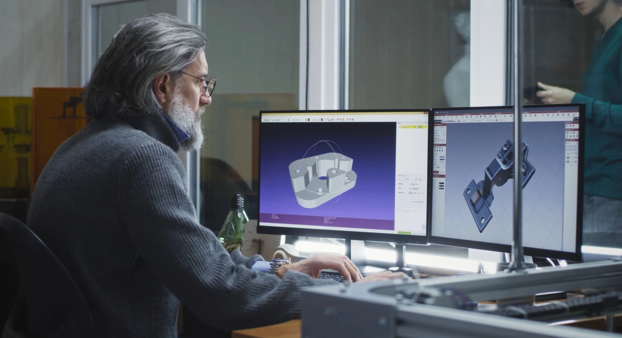
Boosting As-Built Drawings for Architects
In the realm of architecture and design, precision is paramount. Every detail, every measurement, every line matters. Traditionally, architects and designers relied on manual measurements and 2D blueprints. But technology has revolutionized this process. Enter point cloud data. This technology, combined with laser scanning, captures detailed spatial information of structures.
In the realm of architecture and design, precision is paramount. Every detail, every measurement, every line matters. Traditionally, architects and designers relied on manual measurements and 2D blueprints. But technology has revolutionized this process. Enter point cloud data. This technology, combined with laser scanning, captures detailed spatial information of structures. It's a game-changer for creating as-built drawings. In the realm of architecture and design, precision is paramount. Every detail, every measurement, every line matters.
Understanding Point Cloud Data and Its Relevance in Architecture
Point cloud data is a collection of data points in a 3D coordinate system. These points represent the external surface of an object or a structure.
In architecture, point cloud data is crucial. It provides a digital representation of physical spaces. This data aids in creating accurate as-built drawings, 3D models, and visualizations. It's a tool that enhances precision, efficiency, and collaboration in architectural projects.
The Process of Capturing Point Cloud Data
The process of capturing point cloud data involves the use of laser scanning technology. This technology measures the distance between the scanner and the object by emitting a laser beam towards the object and recording the time it takes for the beam to return.
Laser Scanning Technology
Laser scanning technology is a non-intrusive method of collecting detailed spatial data. It captures millions of data points in a short time, providing a high level of detail and accuracy.
This technology is particularly useful in architecture. It allows for the capture of complex structures and spaces, which can then be accurately represented in as-built drawings and 3D models.

Geospatial Technology in Architecture
Geospatial technology plays a significant role in architecture. It enhances the understanding of physical spaces, providing valuable context for design decisions.
With geospatial technology, architects can analyze and interpret spatial data. This data can inform design strategies, helping architects create structures that are in harmony with their surroundings.
Increased Accuracy and Detail
One of the main advantages of point cloud data is its ability to capture a high level of detail. It provides a comprehensive view of the physical environment, capturing every nook and cranny.
This level of detail translates into increased accuracy in as-built drawings. It allows architects and designers to create drawings that accurately reflect the existing conditions of a site or structure.
Time-Saving and Error Reduction
Point cloud data also saves time in the design process. Traditional methods of data collection can be time-consuming and prone to errors.
With point cloud data, architects and designers can quickly capture a large amount of data. This not only speeds up the design process but also reduces the likelihood of errors in the final drawings.
Integrating Point Cloud Data with BIM
Point cloud data can be integrated with Building Information Modeling (BIM) to create a comprehensive digital representation of a building. This integration allows for a more detailed analysis of the building's structure and systems.

Comprehensive Building Analysis
The integration of point cloud data with BIM allows for a comprehensive analysis of a building. It provides a detailed view of the building's structure, systems, and components.
This level of detail can be used to identify potential issues, plan for renovations, and make informed decisions about the building's design and maintenance. It provides architects and designers with a powerful tool for understanding and managing buildings.
Case Studies: Point Cloud Data in Action
Point cloud data has been used in numerous architectural projects to improve accuracy and efficiency. For instance, it was used in the renovation of the historic Notre Dame Cathedral in Paris.
The data helped architects understand the intricate details of the cathedral's structure. It allowed them to create accurate as-built drawings, which were crucial for the restoration process. This case study highlights the potential of point cloud data in preserving architectural heritage.
Overcoming Challenges and Limitations
While point cloud data offers numerous benefits, it also presents some challenges. These include managing large datasets and ensuring data accuracy.
However, with the right tools and training, these challenges can be overcome. For instance, robust data management systems can handle large datasets, while rigorous quality control processes can ensure data accuracy.
Getting Started with Point Cloud Data for Architectural Drawings
For architects and designers new to point cloud data, the first step is understanding the technology. This includes learning about laser scanning and geospatial technology.
Next, it's important to invest in the right tools. This includes laser scanning equipment and software for processing and visualizing point cloud data.
Invest in laser scanning equipment
Learn about geospatial technology
Get software for processing and visualizing point cloud data
Tips for Architects and Designers
When starting with point cloud data, it's crucial to start small. Begin with a small project to understand the process and workflow.
Also, continuous learning is key. Stay updated with the latest advancements in point cloud data technology and applications. This will help you leverage the technology effectively in your projects.
The Future of Architectural Design with Point Cloud Data
Point cloud data is set to revolutionize architectural design. It's not just about creating accurate as-built drawings anymore.
The technology is paving the way for immersive design experiences. Integration with virtual reality (VR) and augmented reality (AR) is becoming more common. This allows architects and designers to visualize and interact with their designs in a whole new way.
Conclusion: Embracing the Digital Transformation
Embracing point cloud data is a step towards the digital transformation of the architectural industry. It's a powerful tool that enhances accuracy, efficiency, and creativity in design. As technology advances, the potential applications of point cloud data in architecture and design will continue to expand.

How Laser Scanning Helps Facilities Managers Maintain Their Commercial Buildings
Leverage the potential of laser scanning to improve your facilities management procedures, ensuring that your commercial properties are kept to the highest standards and continue to be a valuable resource for many years.
In the ever-evolving realm of real estate, digital transformation is no longer a futuristic concept but a present-day reality. Facilities managers, in particular, are reaping the benefits of this shift. One of the most groundbreaking advancements in this field is the advent of laser scanning and point cloud data, a technology that is transforming real estate management by providing precise and comprehensive data about buildings. Let's delve into how laser scanning, including 3D scanning services, is revolutionizing the maintenance of commercial buildings.
The Power of 3D Laser Scanning
Laser scanning, especially terrestrial laser scanning, involves the use of laser technology to capture detailed and accurate measurements of a building’s interior and exterior. This technology is crucial for facilities managers who need to maintain and manage commercial buildings efficiently.
Key Benefits of Laser Scanning for Facilities Management:
Accurate Data Collection
Laser scanning provides highly accurate data about a building's structure, dimensions, and layout. This data is essential for calculating the gross internal area (GIA) and gross floor area (GFA), critical metrics in facilities management. Understanding what the gross floor area means helps in planning maintenance schedules and managing space utilization effectively.
Detailed 3D Models
The data collected through laser scanning can be used to create detailed 3D models of buildings. These models are invaluable for visualizing the current state of the building, identifying potential issues, and planning renovations or maintenance tasks. They also support Building Information Management (BIM) processes, enabling better collaboration and information sharing among stakeholders.
Enhanced Maintenance Planning
Facilities managers can use 3D laser scanning services to detect wear and tear, structural issues, and other maintenance needs that are not always visible to the naked eye. Early detection allows for proactive maintenance, reducing the risk of costly repairs and downtime.
Efficiency and Cost Savings
By utilizing laser scanning, facilities managers can reduce the time and labor required for manual inspections and measurements. The efficiency gained through this technology translates into significant cost savings over time.
Accessibility of Data
3D scanning services are becoming more accessible for facilities managers, making it a practical option for buildings of any size. The digital transformation in real estate is making advanced tools like laser scanning more accessible and affordable.
Real-World Applications in Commercial Buildings
Facilities managers in various sectors, including AEC (Architecture, Engineering, and Construction), are leveraging laser scanning to improve their operations. Here are some practical applications:
Building Condition Assessments
Regular scans can help assess the condition of a building’s structure and systems, ensuring they are maintained to the highest standards.
Space Management
Accurate measurements of GIA and GFA allow for better space management, helping to optimize the use of available space and improve operational efficiency.
Renovation and Retrofit Projects
Detailed 3D models support renovation and retrofit projects by providing precise data for planning and execution. This minimizes errors and ensures that projects are completed on time and within budget.
Compliance and Safety
Laser scanning helps ensure compliance with safety regulations by providing accurate and up-to-date information about the building’s structure and systems.
Conclusion
Laser scanning is transforming real estate management by providing facilities managers with the tools they need to maintain and manage commercial buildings more effectively. As digital transformation in real estate continues to evolve, the adoption of advanced technologies like 3D laser scanning will become increasingly essential. Whether you are searching for "3D laser scanning services near me" or exploring how digital transformation in real estate can benefit your operations, laser scanning offers a wealth of advantages that can help you stay ahead in the competitive world of facilities management.
Embrace the power of laser scanning to enhance your facilities management practices, ensuring that your commercial buildings are maintained to the highest standards and remain a valuable asset for years to come.

The Essentials of Effective Laser Scanning for Building Projects
Laser scanning technology has revolutionized the way we approach construction and architectural projects. Utilizing highly detailed and accurate measurements, 3D laser scanning services are critical in capturing existing conditions and facilitating efficient project planning and management. Whether it's a restoration, renovation, or new construction, understanding the best practices for effective laser scanning can dramatically improve the accuracy and utility of your final models.
1. Choosing the Right Scanner for the Job
The type of scanner plays a crucial role in the success of a laser scanning project. Terrestrial laser scanning (TLS) systems are renowned for their accuracy and are ideal for detailed construction projects. These high-resolution 3D laser scanners provide detailed point cloud data necessary for creating precise 3D BIM models. Facilities managers and project planners should seek out “3D scanning services near me” to find local expertise and cutting-edge equipment.
2. Understanding Measurements and Areas
Laser scanning helps accurately capture both the gross floor area and gross internal area, which are vital for planning and regulatory compliance. The gross floor area means the total area enclosed within the building, including walls, while the gross internal area covers the total area of all floors within the shell of the building. Accurate capture of these measurements ensures that all planning and design activities are based on true physical dimensions.
3. Integration with BIM (Building Information Modeling)
Integrating laser scan data into BIM platforms is a cornerstone of modern AEC (Architecture, Engineering, and Construction) practices. A 3D BIM model enriched with scan data from existing conditions allows architects and engineers to visualize and manipulate real-world conditions in a virtual environment. This integration supports everything from project management to reverse engineering.
4. Maximizing the Level of Detail
The level of detail (LOD) in your captured data can significantly affect your project’s outcomes. For projects requiring high fidelity, it's important to utilize scanners that can capture built data at the desired resolution. This highly detailed point cloud data is essential for creating accurate floor plans and facilitating reality capture, which is crucial for complex or sensitive projects.
5. Effective Project Management
Effective management of laser scanning activities involves careful planning and coordination. Ensure that the scope of scanning provides comprehensive coverage of all necessary areas. Utilize experienced scan technicians who understand the nuances of construction projects and can optimize the scanning process to capture all relevant data efficiently.
6. Use of Advanced Processing Software
Once the scan data is collected, it needs to be processed into usable formats. Advanced software can transform raw data into formats that are compatible with BIM software, enhancing the utility of the captured data. This processing is crucial for ensuring that the data can be effectively used for design, analysis, and decision-making.
7. Regular Calibration and Maintenance of Equipment
To ensure that 3D laser scanners and other related equipment deliver accurate measurements, regular calibration and maintenance are essential. This preventative measure helps avoid potential discrepancies in scan data, which can lead to costly mistakes and delays in construction projects.
8. Collaboration and Communication
Laser scanning projects require the collaboration of various stakeholders, including architects, engineers, construction managers, and facilities managers. Effective communication among all parties ensures that the scan data meets the project’s requirements and supports all phases of the construction lifecycle.
Conclusion
Laser scanning is a powerful tool in the arsenal of modern AEC professionals, offering a path to more accurate, efficient, and detailed building analysis and project management. By following these best practices, professionals can leverage this technology to its full potential, ensuring that their construction projects are not only successful but also optimal in terms of cost, time, and resources. For those seeking “scan services near me,” remember to look for providers that offer the latest in 3D laser scanning technology and have a robust portfolio of successful projects.

Transforming the AEC Landscape: The Revolutionary Impact of Laser Scanning
The Architecture, Engineering, and Construction (AEC) industries are undergoing a significant transformation, driven by the integration of advanced technologies. Among these, laser scanning stands out as a pivotal innovation, revolutionizing project planning, execution, and management. This blog post delves into the myriad benefits of laser scanning, illustrating how it is reshaping the AEC industries.
The Architecture, Engineering, and Construction (AEC) industries are undergoing a significant transformation, driven by the integration of advanced technologies. Among these, laser scanning stands out as a pivotal innovation, revolutionizing project planning, execution, and management. This blog post delves into the myriad benefits of laser scanning, illustrating how it is reshaping the AEC industries.
Precision and Accuracy
Laser scanning, also known as 3D scanning or LiDAR, employs laser light to precisely measure and capture the environment in three dimensions. This technology enables the creation of detailed digital replicas of physical sites, known as point clouds. The accuracy of laser scanning is unparalleled, capturing minute details and irregularities that traditional survey methods might miss. This precision facilitates error detection early in the design phase, reducing costly revisions during construction.
Time and Cost Efficiency
One of the most compelling advantages of laser scanning is its efficiency. Traditional surveying methods are time-consuming and labor-intensive, often requiring multiple site visits. In contrast, laser scanning can capture comprehensive data in a single visit, dramatically reducing man-hours and associated costs. The speed of data acquisition also means that projects can move forward more rapidly, shortening the overall project timeline.
Enhanced Collaboration and Communication
The digital models generated from laser scans can be shared across teams, irrespective of their physical location. This fosters better collaboration and communication among architects, engineers, and construction professionals. Stakeholders can visualize the project in a detailed and interactive 3D environment, making it easier to discuss plans, identify potential issues, and make informed decisions.
Risk Mitigation
Laser scanning plays a crucial role in risk management within the AEC industries. By providing accurate measurements and detailed models of existing conditions, it helps in identifying hazards and planning mitigation strategies beforehand. This proactive approach not only ensures the safety of the construction crew but also minimizes the risk of project delays and cost overruns.
Sustainability
Sustainability is a growing concern in the AEC industries. Laser scanning contributes to sustainable practices by enabling precise material estimations, thus reducing waste. Moreover, the ability to retrofit and rehabilitate existing structures with laser-scanned data supports the preservation of cultural heritage and reduces the need for new materials and construction, aligning with eco-friendly objectives.
Facility Management and Future Modifications
Post-construction, the detailed data acquired through laser scanning prove invaluable for facility management and future modifications. Facility managers can use the digital models for maintenance planning, space management, and energy analysis. Additionally, if modifications are required, the existing digital model provides a precise baseline for planning changes, saving time and resources.
Conclusion
The benefits of laser scanning for the AEC industries are profound and multifaceted. By offering unparalleled precision, efficiency, and collaboration, laser scanning is not just an option but a necessity for modern construction projects. It paves the way for safer, more sustainable, and cost-effective practices, ensuring the long-term success and resilience of the AEC industries. As technology continues to advance, the integration of laser scanning will undoubtedly become more widespread, further enhancing its impact on the field. The future of construction lies in embracing these technological innovations, with laser scanning leading the charge in transforming the AEC landscape.